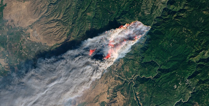
Historical Fire Perimeters
The Fire and Resource Assessment Program (FRAP) annually maintains and distributes an historical fire perimeter data set from across public and private lands in California. The GIS data is jointly developed with the cooperation of the United States Forest Service Region 5, the Bureau of Land Management, the National Park Service and the Fish and Wildlife Service and is released in April.
Although the database represents the most complete digital record of fire perimeters in California, it is still incomplete, and users should be cautious when drawing conclusions based on the data. To learn more about potential errors and their sources, please refer to the Existing Errors and Corrections section.
Fire Perimeter ESRI Blog
Fire Perimeter Data
The fire perimeters database includes two layers—historical fire perimeters (firep) and prescription treatments using fire (rxburn). Use cases include:
- Improving fire prevention, suppression, and initial attack success.
- Reduce and track hazards and risks in urban interface areas.
- Provide information for fire ecology studies for example studying fire effects on vegetation over time.
Methodology
The statewide fire history geospatial dataset is updated annually in the spring by standardizing and combining digitized fire perimeters. These are collected from CAL FIRE’s units across the state as well as from cooperating agencies (Bureau of Land Management, California State Parks, National Park Service, United States Forest Service, United States Fish and Wildlife). Besides last year’s new perimeters, updates contain corrections, subtractions, and additions from past years as applicable. Actions are taken to ensure completeness of the data collected, cross checking with various reporting systems, with errors corrected to the best of our ability. Actions are taken to ensure completeness of the data collected, cross checking with various reporting systems, with errors corrected to the best of our ability. Updates contain corrections and additions from past years as applicable. Addition and alteration specifics for each version published since 2014 can be found in the Update Lineage Details section below.
Collection criteria for CAL FIRE units has changed over time as follows:
~1991: ≥10 acres timber, ≥30 acres brush, ≥300 acres grass, damages or destroys three residence or one commercial structure or does $300,000 worth of damage, or results in loss of life.
~2002: ≥10 acres timber, ≥50 acres brush, ≥300 acres grass, damages or destroys three or more residential or commercial structures (doesn’t include outbuildings, sheds, chicken coops, etc.), or results in loss of life.
~2008-present: ≥10 acres timber, ≥50 acres brush, ≥300 acres grass, damages or destroys three or more structures or does $300,000 worth of damage, or results in loss of life.
Collection criteria for all cooperating agencies:
All fires ≥ 10 acres
The current version’s updates:
Firep24_1 was released in April 2025. Five hundred forty-eight fires from the 2024 fire season were added to the database (2 from BIA, 56 from BLM, 197 from CAL FIRE, 193 from Contract Counties, 27 from LRA, 8 from NPS, 55 from USFS and 8 from USFW). Six perimeters were added from the 2025 fire season (as a special case due to an unusual January fire siege). Five duplicate fires were removed, and the 2023 Sage was replaced with a more accurate perimeter. There were 900 perimeters that received updated attribution (705 removed “FIRE” from the end of Fire Name field and 148 replaced Complex IRWIN ID with Complex local incident number for COMPLEX_ID field). The following fires were identified as meeting our collection criteria but are not included in this version and will hopefully be added in a future update: Addie (2024-CACND-002119), Alpaugh (2024-CACND-001715), South (2024-CATIA-001375). One perimeter is missing containment date that will be updated in the next release.
Cross checking CALFIRS reporting for new CAL FIRE submissions to ensure accuracy with cause class was added to the compilation process. The cause class domain description for “Powerline” was updated to “Electrical Power” to be more inclusive of cause reports.
Firep23_1 was released in May 2024. Two hundred eighty-four fires from the 2023 fire season were added to the database (21 from BLM, 102 from CAL FIRE, 72 from Contract Counties, 19 from LRA, 9 from NPS, 57 from USFS and 4 from USFW). The 2020 Cottonwood fire, 2021 Lone Rock and Union fires, as well as the 2022 Lost Lake fire were added. USFW submitted a higher accuracy perimeter to replace the 2022 River perimeter. Additionally, 48 perimeters were digitized from an historical map included in a publication from Weeks, d. et al. The Utilization of El Dorado County Land. May 1934, Bulletin 572. University of California, Berkeley. Two thousand eighteen perimeters had attributes updated, the bulk of which had IRWIN IDs added. A duplicate 2020 Erbes perimeter was removed. The following fires were identified as meeting our collection criteria but are not included in this version and will hopefully be added in the next update: Big Hill #2 (2023-CAHIA-001020).
YEAR_ field changed to a short integer type. San Diego CAL FIRE UNIT_ID changed to SDU (the former code MVU is maintained in the UNIT_ID domains). COMPLEX_INCNUM renamed to COMPLEX_ID and is in process of transitioning from local incident number to the complex IRWIN ID. Perimeters managed in a complex in 2023 are added with the complex IRWIN ID. Those previously added will transition to complex IRWIN IDs in a future update.
Firep22_1 was released in April 2023. Three hundred five fires from the 2022 fire season were added to the database (1 from BIA, 8 from BLM, 176 from CAL FIRE, 49 from Contract Counties, 14 from LRA, 8 from NPS, 38 from USFS, and 11 from USFW). The 2021 Dotta (part of Beckwourth Complex), Greenhorn, and Hartman fire perimeters were added. Another 45 fires were added by USFW from 2015-2021. The 1988 Hessel fire was added in LNU. The 2019 Cave fire was replaced with a more detailed perimeter submitted by Santa Barbara County. The 2017 Hudson, 2017 Lake, 2017 Jones, 2017 "37", 2019 Tucker, and 2019 Refuge perimeters were replaced with imagery digitized perimeters from USFW. Attributes were updated for 32 records. One hundred ten perimeters were removed due to duplication or being completely contained outside of California state borders. The field IRWINID was added to provide a unique ID; fires before 2022 are lacking this attribution (with the exception of those added in this publication where possible). The following fires were identified as meeting our collection criteria, but are not included in this version and will hopefully be added in the next update: 2022 Cable (CAL FIRE, AEU), 2022 All American (BIA, CRA).
Firep21_2 was released in October 2022. The fields COMPLEX_NAME and COMPLEX_INCNUM were added to the dataset; historical complex fires were updated as such to the best of current ability. COMPLEX_NAME is for fires that were initially individual fires (with their own name) and then became part of a complex and thus were given a new name by the fire management agency. COMPLEX_INCNUM was created for the same reason as COMPLEX_NAME. Ten fires were added (2008 Coleman 1, 2008 Dedrick, 2008 East, 2008 Star, 2012 Hello, 2020 Lytle, 2021 Coyote, 2021 Devore, 2021 Dotta, 2021 Lone). The 2008 Paradise fire perimeter was spatially adjusted to more accurately account for its location. Six perimeters were removed, becoming a complex. The 1996 Columbia Hill and Shields Camp perimeters were removed due to confirmation of their status of prescribed burn. The 2014 Coffee fire was replaced by a more accurate perimeter. Thirty-two records' attributes were updated, mostly CAUSE data from 2019 and 2020.
Firep21_1 was released in April 2022. Three hundred seventy-two wildfires from the 2021 fire season were added to the database (21 from BLM, 223 from CAL FIRE, 3 from DOD, 40 from LRA, 15 from NPS, 66 from USFS, 2 from BIA, and 2 from USFW). The following fires were identified as meeting our collection criteria but are not included in this version and will hopefully be added in the next update: Dotta (part of Beckwourth Complex), Greenhorn, Hartman, Lone Rock, Union, and Nelson. The 1933 Griffith Park fire, 2018 Bridal fire, 2020 Kare fire, 2020 Green fire, 2020 Indian fire, 2020 Tripp fire, 2020 Apple fire, and the 2020 Gulch fire were added. A duplicated 1912 fire was removed, 31 perimeters were replaced with more accurate perimeters, and six perimeters’ attributes were adjusted (if you would like a full briefing on these adjustments please contact us).
Firep20_1 was released in April 2021. Five hundred wildfires from the 2020 fire season were added to the database (12 from NPS, 277 from CAL FIRE, 76 from USFS, 37 from BLM, 3 other). Two previous fires were modified, the 1994 Steckel fire was deleted, and the two 1979 Hernandez were merged into one fire.
Firep19_1 was released April 30th, 2020. Three hundred twelve wildfires from the 2019 fire season were added to the database (4 from the NPS, 180 from CAL FIRE, 68 from USFS, 21 from BLM).
Firep18_1 was released May 1st, 2019. 413 wildfires from the 2018 fire season were added to the database. There are two fires on BIA managed land that do not have 3 letter code identifiers, thus "Unit" was left blank. A hand drawn perimeter of the 1990 San Juan Canyon fire in BEU was submitted by a fire fighter who worked on the fire. The perimeter of the Thomas fire of 2017 was replaced this year by one collected by SBC that is based on someone walking some parts of the perimeter for better accuracy.
Firep17_1 was released April 13th, 2018. 612 wildfires from the 2017 fire season were added to the database. Three USFS wildfires from previous years were also added (1 from 2014, and 2 from 2016). Attributes from three USFS wildfires were also corrected (Willow 2015, Gilman and Meadow 2016). Two new USFS Forest were added to the domain list of Units (Rogue River-Siskiyou NF & Fremont NF). The Barry Point Fire is now attributed to the Rogue River-Siskiyou, previously it was attributed to other (as a unit).
Firep16_1 was released May 4th, 2017. One 2014 VNC fire perimeter was replaced by a more accurate version. Three new perimeters from 2014 were added (VNC). A new perimeter from 2013 was added. Sixty-six new perimeters from 2015 were added. Ninety-two new perimeters in Marin County, from 1917 to 1934 were added. They were hand drawn by the Marin County fire Chief Garber and digitized and submitted by NPS. Eight duplicate fire perimeters were deleted.
Firep15_1 was released June 9th, 2016. The ALARM_DATE and CONT_DATE fields have been changed from STRING fields to DATE fields. In the many cases where only the year of a fire existed (ex. 19170000) the tool couldn't process the data and the entry is NULL. In those cases, the year can be found in the YEAR field.
Firep14_1 was released in May 2015. After release, the NPS supplied corrections for 14 wildfires and 67 prescribed burns. The corrected data was posted to FRAP's data download page as fire14_1 in late May. An effort was made to ensure multipart polygons were standardized throughout the dataset.
Firep14_2 was released in July 2015 to reflect that changes had been made to the original release in late May. Version 14_1 from late May is an exact copy (spatially) of version 14_2 released in July.
Fires are undoubtedly missing or contain missing or incorrect attribute data. Some fires are missing because historical records were lost or damaged, were too small for the minimum cutoffs, had inadequate documentation or have not yet been incorporated into the database. For example, the 2008 Lone Pine fire perimeter has never been collected and may never be.
Other errors with the fire perimeter database include duplicate fires and over-generalization. Although the data capture process attempts to identify duplicate fires resulting from multiple data sources (e.g., the USFS and CAL FIRE both captured and submitted the fire perimeter), some duplicates may still exist. Additionally, over-generalization, particularly with large old fires, may show unburned "islands" within the final perimeter as burned. Users of the fire perimeter database must exercise caution in application of the data. Careful use of the fire perimeter database will prevent users from drawing inaccurate or erroneous conclusions from the data. If you have any question please contact fire scientist, Dave.Sapsis@fire.ca.gov.
Analysis utilizing GIS tools resolves many duplication errors, but instances exist where despite various efforts, there is no conclusive evidence to delineate which perimeter is the correct one to keep. Still more are yet to be identified and corrected.
Efforts to fill in missing attribution continue. For instance, following investigation of the cause of a fire, the attribute CAUSE, may be updated from Unknown/Unidentified to something specific.
Special thanks go out to all the fire historians across the state that have contributed to identifying and correcting missing or incorrect perimeters from years past.
Many users of the dataset have located errors, resulting in their correction. If errors are discovered, please contact the data steward, Kimberly.Wallin@fire.ca.gov.